
The first part of this post detailed the walk from West Stockwith to Misterton. This part covers the walk though the rest of Misterton and back to my starting point.
I’ll begin with All Saint’s church, a Grade 1 listed building that dates back to the 13th century (although it was largely rebuilt in the mid-19th century. It was a little awkward trying to compose a shot of the church from the entrance to the grounds to the east (the perils of a fixed-lens camera), but a better view was possible from the west, albeit with the church partially obscured by a couple of evergreen trees.


I sometimes go inside churches if they are open, as there is usually something of interest to look at and photograph, but I didn’t have time on this trip. Instead I took the following picture of one of the stained glass windows from the outside. This is perhaps not the best way to appreciate stained glass, but I quite liked the patterns of the lead-work.

Leaving the church along Church Lane, I rejoined the main road through Misterton (the B1403). The road changes names from Church Street to Gringley Road near here and an old-style black and white fingerpost donates directions to various places. I think this one is ready for a lick of fresh paint.

Following Gringley Road south passes a variety of interesting old houses before reaching a bridge that crosses the Chesterfield Canal. It was here that I left the road to join the Cuckoo Way footpath that follows the canal all the way from its source in Chesterfield in Derbyshire.
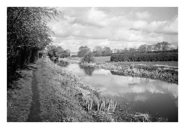
The canal skirts the southern side of Misterton, passing beneath a few bridges, such as this one that carries Grovewood Road.

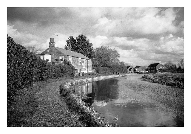
Further down the canal, it curves attractively past some houses where a man and two boys were fishing, before reaching a series of locks. One of the houses between these locks had a small boat moored beside it’s back garden

The canal then follows a straight route back towards West Stockwith. There were many narrow-boats moored along this stretch.

There’s a final bridge carrying the main road through West Stockwith before the canal enters Stockwith Basin, a marina that opens directly into the River Trent via locks.

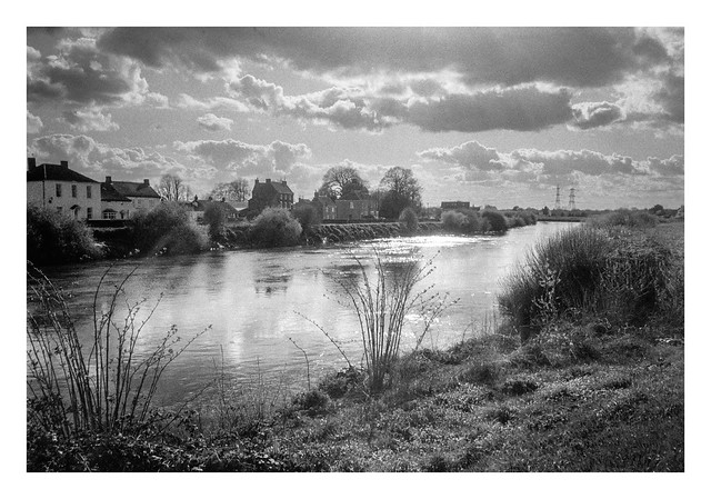
The final stretch of the footpath route follows the flood-bank on the west side of the Trent. The Trent is the third longest river in the UK, flowing 185 miles from its source on Biddulph Moor in Staffordshire, to Trent Falls in Lincolnshire, where it discharges into the Humber Estuary. The river is navigable to Burton on Trent in Staffordshire.
Leaving the riverbank before the mouth of the River Idle, I crossed the bridge across the Idle and back to my start point in West Stockwith.

I enjoyed this walk. The weather was pleasant, the light was nice for photography, and there was plenty to see along the way.
Olympus XA3 & Ilford HP5+ (@800asa). Ilfotec DD-X 1+4 10mins @ 20°
Taken on 24 March 2024
